
Our unique end-to-end GIS, mapping, data collection and analysis technologies include everthing required for efficient, effective, sustainable land-use and geospatial systems —
Now and into the future.
Advanced Geographic Information Systems (GIS), mapping services and support for effective land management, asset supervision and cadaster.
We use state-of-the-art technologies to provide ‘fit for purpose’ solutions for all geo-related challenges.
Look at some of what we’ve accomplished so far

We apply our expertise in
GIS & mapping systems, data
analysis and related disciplines
to understand and fulfill our
customers’ needs.

We create propreitary, state-of-the-art soiftware and technologies to provide ‘fit for purpose’ solutions for all geo-related challenges.

We never stop searching for new and better ways to provide geospatial solutions, always holding ourselves
to the highest standards.


Our unique end-to-end GIS, mapping, data collection and analysis technologies include everthing required for efficient, effective, sustainable land-use and geospatial systems —
Now and into the future.
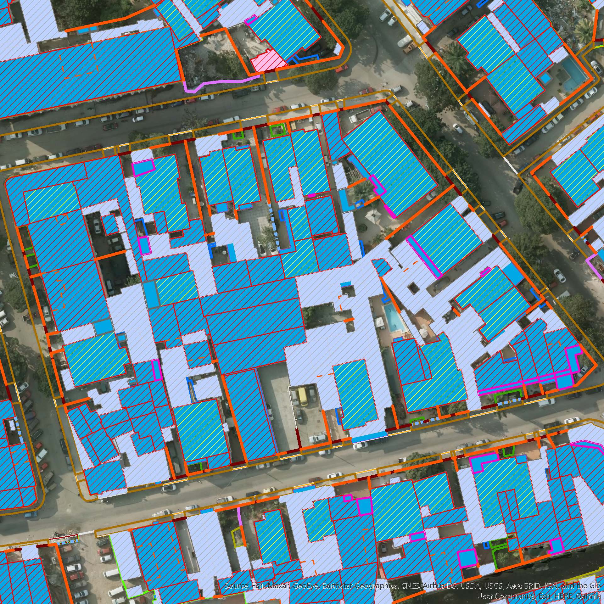
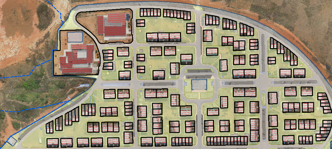
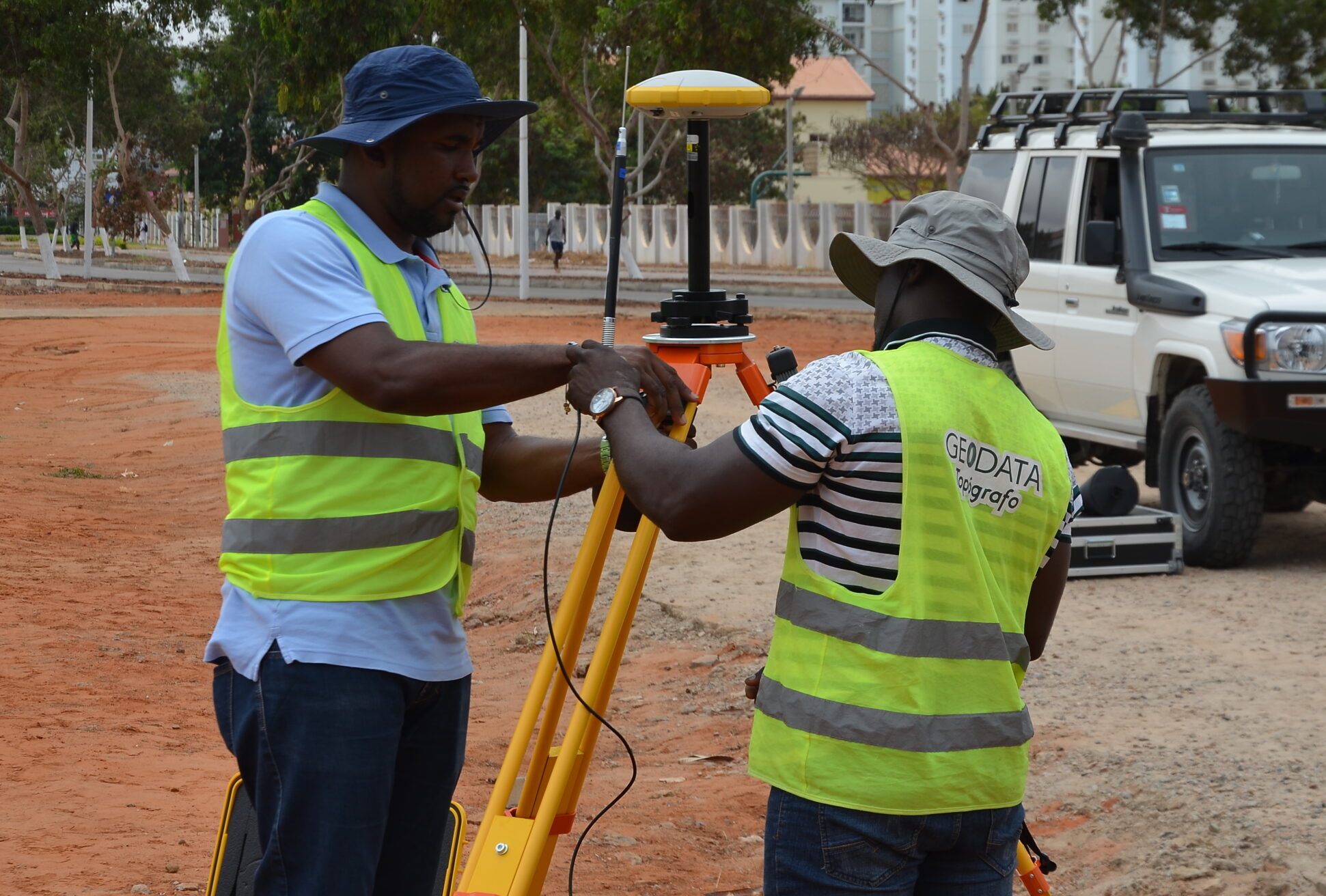
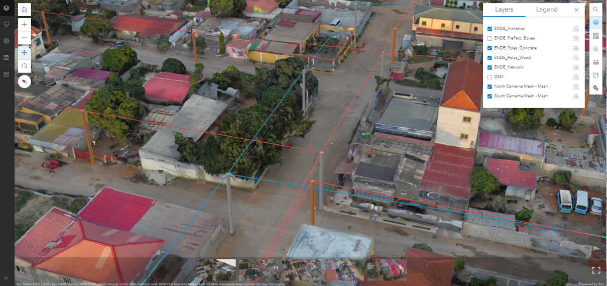
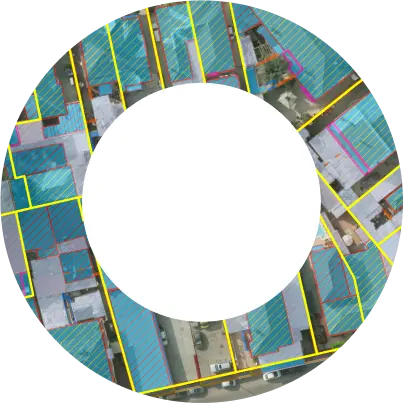
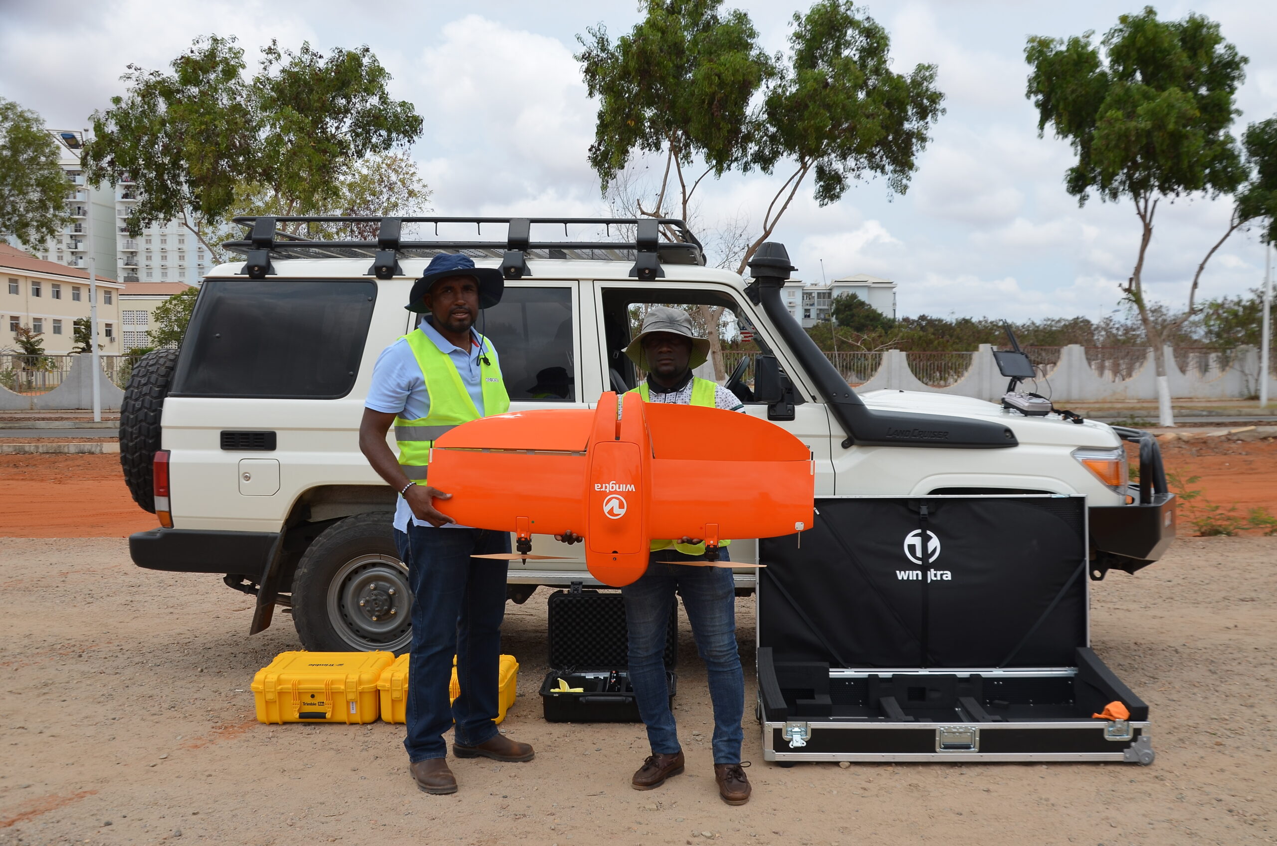
Geo Data employs the world’s most advanced technologies, many of them developed in-house, to provide ultra-accurate, multi-layered mapping and scanning, accomplished faster and more cost-effectively.
Our unique end-to-end GIS, mapping, data collection and analysis technologies include everthing required for efficient, effective, sustainable land-use and geospatial systems —
Now and into the future.
Our unique end-to-end GIS, mapping, data collection and analysis technologies include everthing required for efficient, effective, sustainable land-use and geospatial systems —
Now and into the future.
Our unique end-to-end GIS, mapping, data collection and analysis technologies include everthing required for efficient, effective, sustainable land-use and geospatial systems —
Now and into the future.
Our unique end-to-end GIS, mapping, data collection and analysis technologies include everthing required for efficient, effective, sustainable land-use and geospatial systems —
Now and into the future.
Our unique end-to-end GIS, mapping, data collection and analysis technologies include everthing required for efficient, effective, sustainable land-use and geospatial systems —
Now and into the future.
Our unique end-to-end GIS, mapping, data collection and analysis technologies include everthing required for efficient, effective, sustainable land-use and geospatial systems —
Now and into the future.
Geo Data learns your unique geographical attributes and ownership regulations, integrating and translating them into actionable insights that impact land and property management.
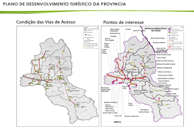

Geo Data’s solutions focus on acheiving the United Nations Sustainable Development Golas, including: