This nationwide project called for the legalization and regularization of some 200,000 housing properties in various development towns, as well as of properties confiscated by the state since 1975.


Such a complex national project required coordination and cooperation among numerous government ministries, some of which had not previously interacted with one another. Geo Data was also called upon to provide dedicated legal work and legislation support and the production of urban plans.

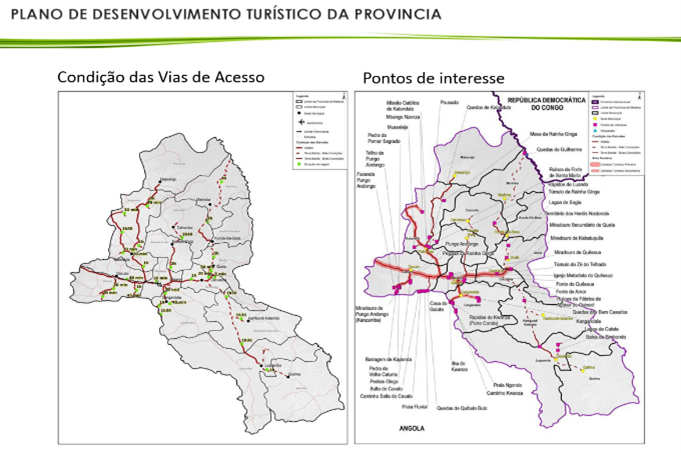
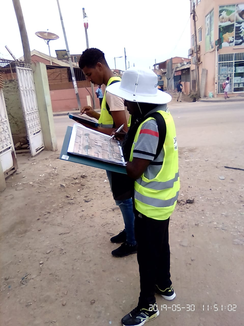
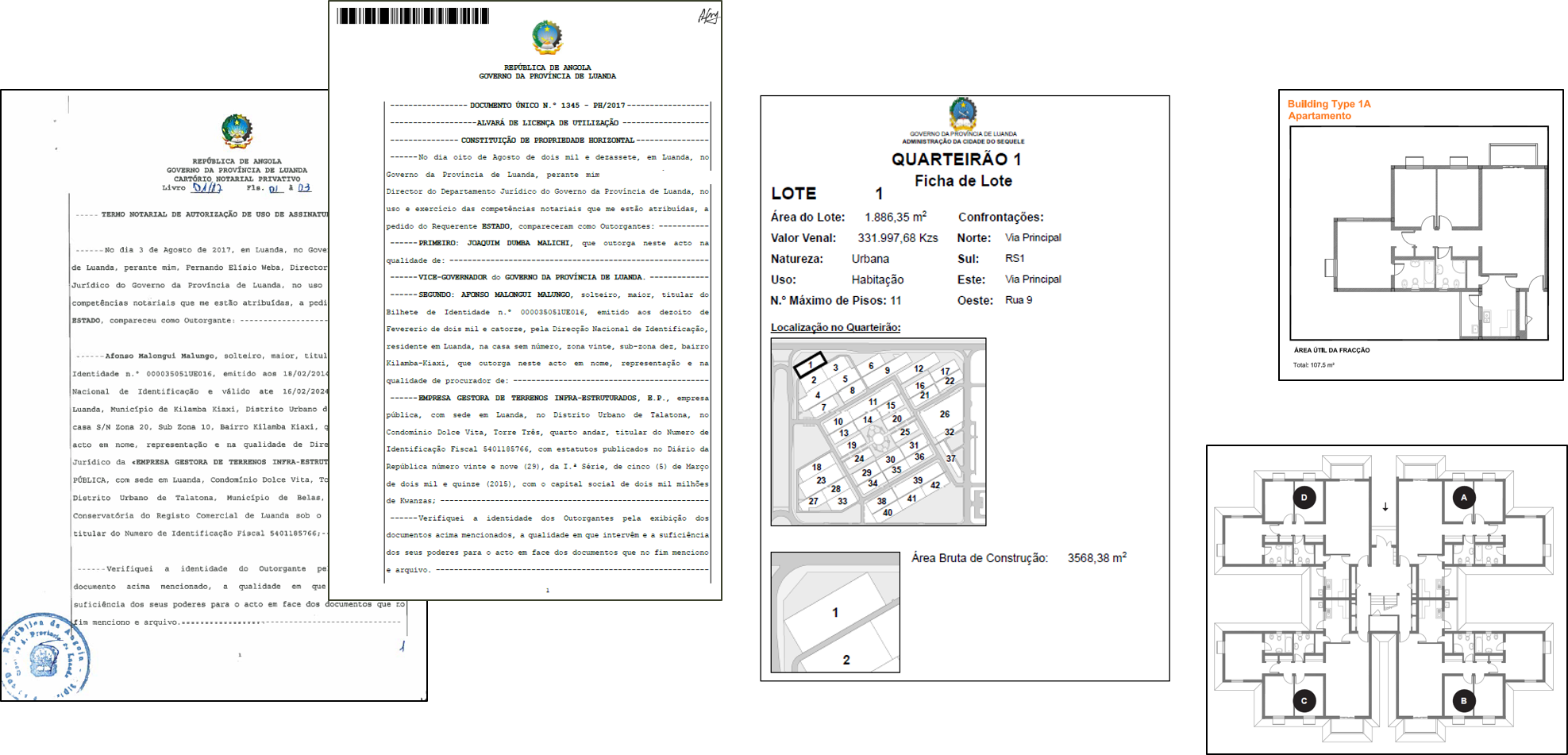
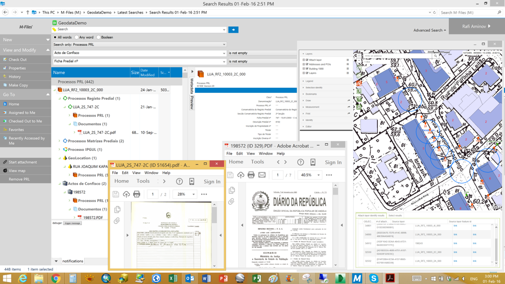
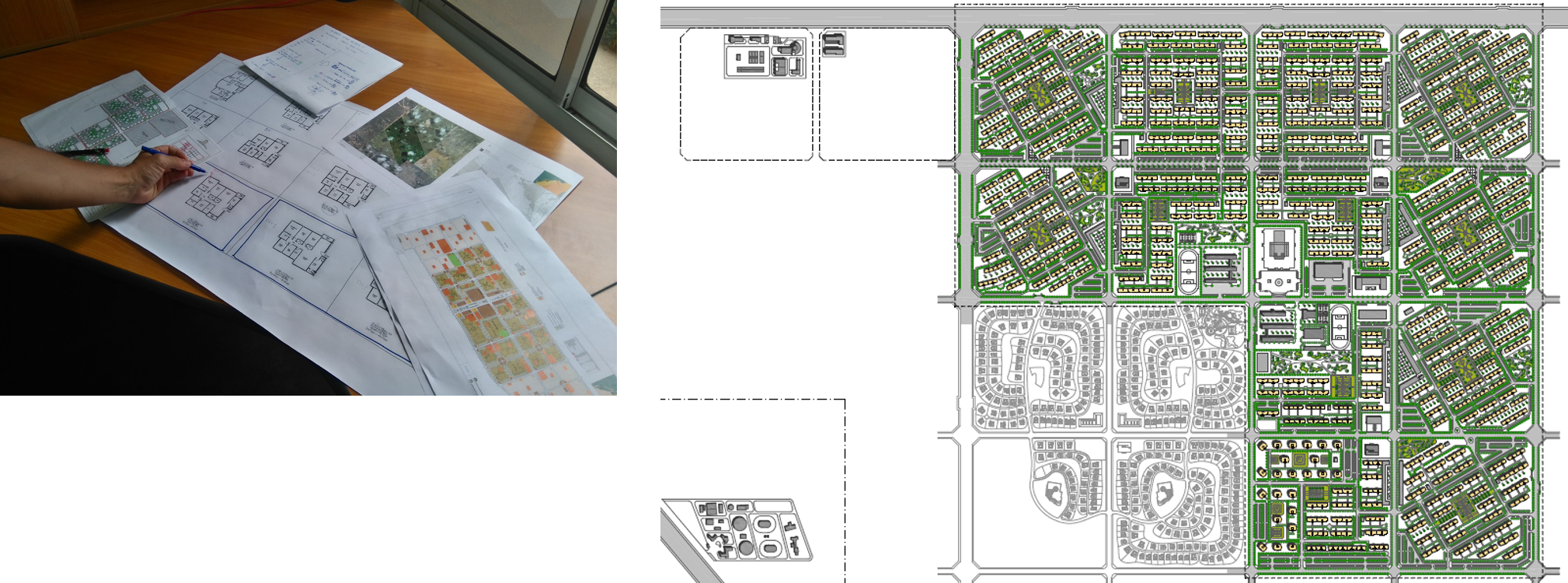
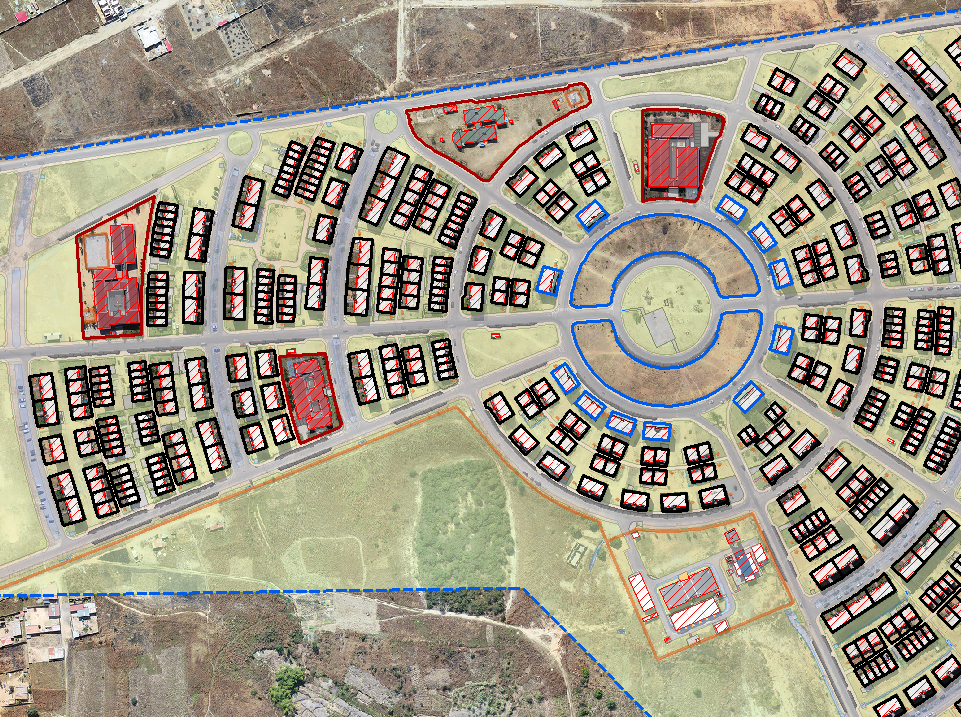
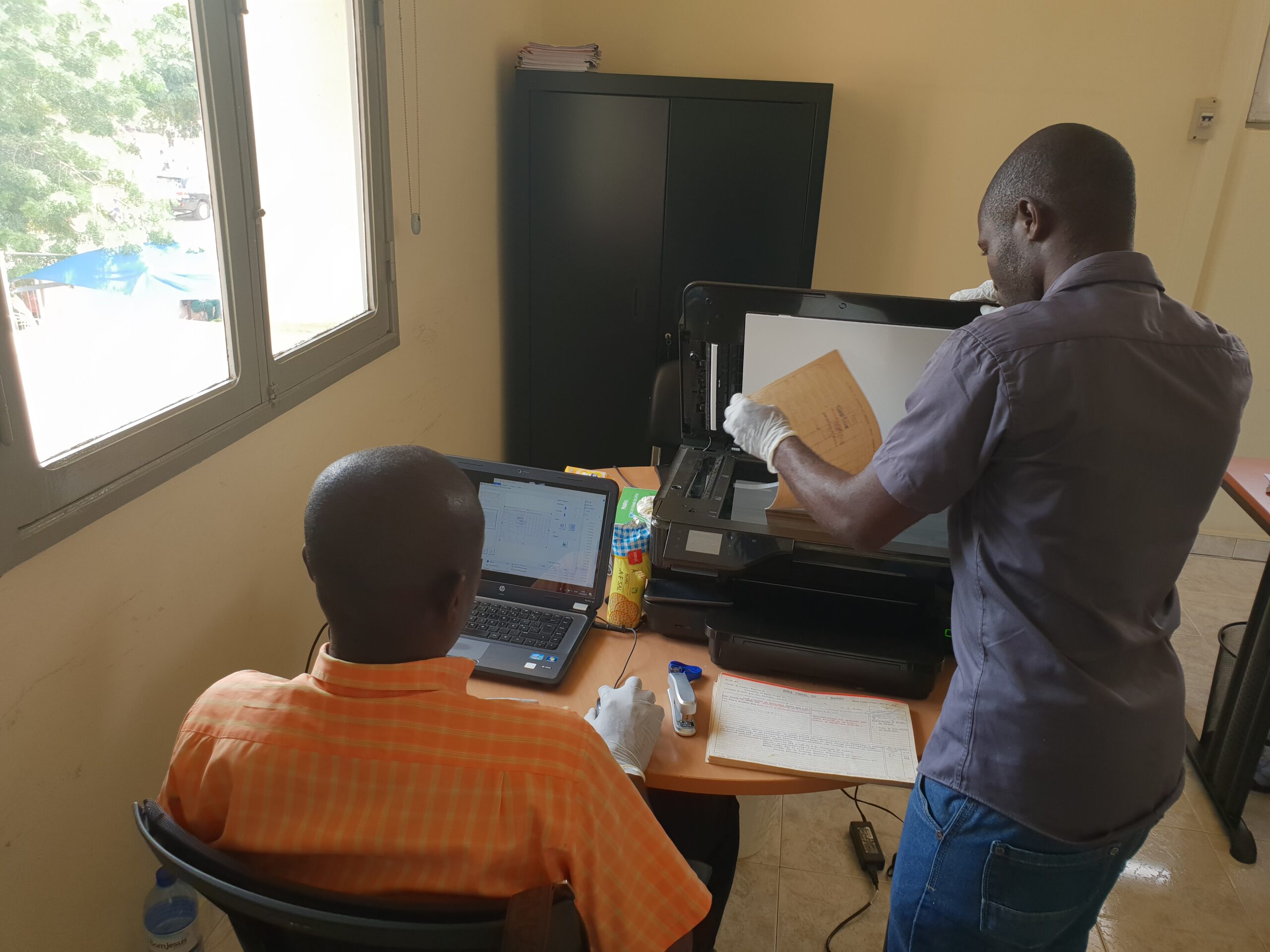
More than 3000 km² had to be surveyed in accurate aerial photos, with geo-referencing, mapping and interpretation. More than 2.4 million documents from various public entities also had to be scanned and indexed to assure reliable information for orderly and balanced growth.

Geo Data employed advanced geographic information system (GIS) technology and high-resolution aerial photography to accurately represent and provide geo-reference data for all the properties involved. The resultant national property registration system is based on unique identification numbers, integrated into the tax administration database. Additional IT modules allowed the issuance of registration certificates and communication between notaries and the registries, adapted to the varying demands of all the entities involved. Geo Data also assisted in the passage of relevant new legislation. Geo Data also trained and transferred knowledge to pubic administration employees in order to build autonomous local teams.

With the implementation of the project, Angola now has an accurate, orderly basis for housing property legalization and regularization, in a software-based system that provides access for a wide range of users.